Wednesday, October 18, 2006
Tuesday, October 17, 2006
Bucegi, home of the wild chamois
This summer I had the opportunity to take a few nice photos of the wild chamois living in the Bucegi mountains. The pics with the chamois are to the end of the photo set (pics no. 39-51)

Enjoy,
Peter

Enjoy,
Peter
Poiana Brasov
Poiana Brasov, surrounded by the Postavarul Mountain, is well known as one of the best ski resorts in Romania, with its 12 ski sloapes of various difficulty degrees. If you would like to reach the top of the mountain, you can take the cable car, or you can choose one of the well marked hiking routes.

Peter

Peter
Calimani, volcanic mountains
Calimani Mountains are the highest and largest volcanic mountains in the Eastern Carpathians, with its highest peak, the 2100 m high Pietrosul Peak. A long ridge with great landscapes, large forests and strange rock formations.

Peter

Peter
Ciucas, mountains of outstanding beauty
Ciucas Mountains are less known and visited, but of outstanding beauty. It is a smaller mountain with its highest peak the Ciucas Peak, at 1954 m.
Peter
Peter
Seven Ladder Waterfall
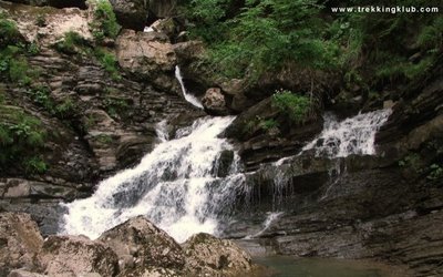
Don't be depressed by the first photos (those with garbage everywhere), the Seven Ladder Waterfall is the most spectacular part of the Piatra Mare Mountains.
Peter
Peter
Sugo Cave
The Sugo Cave is the biggest cave in Giurgeu Mountains, with 1021 m total lenght of galleries, 142 m extension and 67 m dislevelment. The cave has 3 fossile levels above its active passage. It is rich in speleothems like aragonite crystals and concretions, helictites and mace-like stalactites. Only the first 120 m from the cave's entrance are easily accessible for tourists. Saturdays and sundays you can find a cave guide in the wooden house, close to the caves main entrance.
Peter
Peter
Bike-hike to Madaras Peak
Bike-hike to Harghita Madaras peak, 1801 m, the highest peak of the Harghita Mountains. Daffodils (narcissi) and charcoal-burners.
Peter
Peter
Huda lui Papara
Huda lui Papara, the most impressive cave from the Trascau Mountains stretches on 2,000 m along a subterranean river, with lakes and waterfalls, wide rooms and spectacular narrow tracts. Next time I hope to visit the cave itself,
Peter
Peter
Self-made snowshoes
Last week I have decided to try my new self-made snowshoes, made from polypropylene pipe and banner-material.
r2012.jpg
So, I went on a hike to the Piatra Singuratica (The Single Stone), situated in the Hasmas Mountains.
Piatra Singuratica offers a beautiful view over the Ciuc depression (the area where I live) and is separated by a saddle from the top of Ecem's rocky walls, 1696 m (this time I came through this mountain pasture) and Hasmasul Mare peak, 1793 m (which I would like to hike next time this winter).
Peter
Saint Ann Lake
I have made a first hike to this near volcanic lake on a gloomy, snowy sunday morning. Lake Saint Ann (Romanian: Lacul Sfanta Ana, Hungarian: Szent Ann-tó) is a crater lake located in the volcanic crater named "Puciosul" of the Eastern Carpathians, near Tusnad (Tusnád) in the Natural Reserve of Mohos, Harghita County, Romania. It has an area of 220,000 m2 and has a maximum depth of 7 m.
Peter
Peter
Killer Rock
In 1837, which was a particularly rainy year, the heavily soaked clay surface of the side of the Killer Rock (Gyilkos-kő - Piatra Ghilcos) slid and blocked the Bicaz Brook. The Red Lake was the result of this landslide which dammed the course of the brook.
After the landslide, the limestone mixed with clay blocked the oozing waters and the lake gradually developed. The petrified trunks of the trees which once covered the valley can still be seen. The water containing ironoxide and lime preserved these tree trunks. In clear weather the lake mirrors the red lime rocks on its margins.
The name Killer comes, according to the legend, from the fact that during the catastrophe shepherds were grazing their flocks and they were swallowed by the falling earth.
Peter
The Gorges of Warm Somes
The Gorges of the Warm Somes (Cheile Somesului Cald), are situated in the Padis Plateau, in the northern part of the Bihor Mountains. They offer some spectacular and wild scenery. In the upper part of the gorges, Radeasa creek carved an impressive tunnel, the Fortress of Radeasa (Cetatile Radesei).
Peter
Peter
One of the largest ice caves in the world
The Scarisoara Ice Cave is situated in the Bihor Mountains, at 1200 m altitude, and shelter a glacier with a volume varying between 40000 and 55000 m3. It is said to be one of the largest ice caves in the world. An ice cave is a cave which contains ice, not a cave formed in ice. Those are called glacier caves.
The entrance is a 48 m deep and 60 m wide shaft. A stair of steep iron steps spiralles around the shaft until it reaches the bottom. The hall at the ground is filled with ice all year round. The reason for this situation is the height and the special shape of the cave. The cave stores the low temperature, as the cold air is heavier than the warm air outside.
This first chamber is already filled with ice. But the most impressive ice structures, the spectacular six meters high ice stalagmites, are found in the second chamber of the cave. The cave is very cold, so it is essential to use warm clothes and good shoes. The paths across the ice are very difficult to go.
Peter
New set of photos
I have posted a new set of photos from Piatra Craiului Mountains. It was a short hike to the Tower of Piatra Craiului peak, 1923 m.
Peter
Peter
Ciur-Ponor cave system and the longest underground river
The Ciur-Ponor - Toplita de Rosia cave system is situated in the Padurea Craiului mountains and has a surveyed length of 17,078 m and a total vertical development of 225 m (+25 m, -200 m).
The direct distance between the upstream swallet and the main outlet at Toplita de Rosia is 3,025 m. The cave system contains nearly 9,500 m of generally active galleries, the longest underground river in Romania, 5,000 m.
Peter
The direct distance between the upstream swallet and the main outlet at Toplita de Rosia is 3,025 m. The cave system contains nearly 9,500 m of generally active galleries, the longest underground river in Romania, 5,000 m.
Peter
Photos from King's Cave
Photos from Pestera Craiului (Király-barlang, King's Cave), a 3500 m long cave from Padurea Craiului Mountains.
Padurea_Craiului
Peter
Padurea_Craiului
Peter


